


India Satellite Weather

توضیحات India Satellite Weather
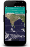
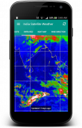
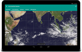
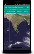
"یک تصویر ارزش هزار کلمه است". داده های آب و هوا پیچیده را می توان به راحتی با یک تصویر نقشه منتقل می شود. با مشاهده تشکل های ابر در اطراف شهر خود را، شما به راحتی می توانید پیش بینی اینکه آیا روز است برای رفتن به داغ و یا بارانی / ابری.
آن را بسیار خوب با قابلیت ذخیره داده ها مجهز و هرگز داده های تکراری را دانلود از سرور. نقشه ها آب و هوا دانلود به صورت محلی ذخیره خواهد شد و می توانید آنلاین قابل دسترسی است.
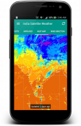
این نرم افزار بازخوانی آب و هوا نقشه به طور مستقیم از هند هواشناسی گروه (www.imd.gov.in) و CIMSS [USA] (http://cimss.ssec.wisc.edu)
FYI: من واقعا نمی کنترل در گم منطقه شمال هند از برخی از انواع نقشه نیست زیرا آنها توسط ایالات متحده آمریکا هواشناسی وزارت ارائه شده است.
این نرم افزار منبع باز است: https://github.com/Shahul3D/IndiaSatelliteWeather
احساس رایگان برای کمک!

India Satellite Weather - اطلاعات APK
نسخه APK: 5.0.6حزمة: com.shahul3d.indiasatelliteweatherآخرین نسخه India Satellite Weather
سایر نسخهها


اپلیکیشنها در دسته مشابه

شاید دوست داشته باشید...


